Land Surveyors United - Surveying Education Community
2020-12-22T17:51:38.000Z
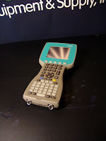
Anyone is familiar with Leica Geiod Reader?
Enclosure: https://landsurveyorsunited.com/hubs/leicasupportgroup/forum/geiod
Anyone is familiar with Leica Geiod Reader?
Hi every body
I have 2 GPS 530 Leica.But one of them do not give enough satellite for fixing.And i set up firmware 5.1 and i changed Antenna but again did not give more than 4 satellite.Please tell me how can i do.
THANKS.
Go to Computation then Edit- Elevation- option click Elev Diff. encode -.330. Dont forget block for multiple elevation average change.
Hi Guys
I got my photo control and processing all figured out for Normal projects with good geometry but im having a hard time figuring out how to place and space control points for narrow road strip.
Check out this collection of Drone Surveying Videos for learning the basics related to surveying with UAVs and Drones.
Good afternoon,
I am just about to launch a new small business called Ground Control Surveys.
I live in Sydney, Australia.
The business will offer both UAV Mapping and Processing.
Having read a whole lot of forums over the last few years, I have seen that there are a large number of people who want to take advantage of UAV's for mapping, but who don't have the time to experiment with all the processing software/s.
For those local to my area, I can fly the drone (Licensed CASA pilot) and process the images.
But for those who may be interstate or overseas; I am more than happy to process the imagery that you may have taken.
I can also discuss the flight planning, ground control placement, camera settings etc with you, to ensure the imagery is of sufficient quality.
I have refined the process over the last 2 years and have found that Photoscan allows for the most customisation, which, done correctly, leads to the most accurate results; however, if you require the imagery processed in similar software, that can usually be arranged.
If anyone would like to know more, I can share with you my past projects and the accuracy analysis.
I can also assist with the analysis after the processing is complete eg. categorising the point cloud, creating a bare-Earth model, generating contours and exporting them as a DXF, creating a 10 x 10m grid and sampling heights at these locations etc.
Don't hesitate to ask any questions, I'm happy to share some quick tips on this or any related topics (QGIS, GlobalMapper etc).
Kind regards,
James Wallace
We have recently acquired an eBee plus and interested in others experience and tips in optimizing the workflow in Agisoft, in particular using a geoid model where the local geoid model is not well defined (outside South Africa) We always use accurate ground control points to verify results. The geoid model is fairly well defined in South Africa with an accuracy or standard deviation of 7cm. Has anyone used a geoid specific to Africa and verified against true orthometric heights, and if so where?
I stumbled across a terrific resource called Drone Made which outlines the legality of operating drones in pretty much all countries of the world. Following drone rules can be a hard thing to do, especially if you are continuously travelling. We are a community of travellers from all around the world & created the first truly global and up to date Drone Laws World Map(s)!
European Drone Laws
EuropeLiechtenstein
Montenegro
San Marino
Serbia
hi. i hope there are people out there using embedded cad and can answer questions i can't find in there wonderful videos.
we are converting over from the great antique land desktop 3. been using it for 20 years now but need to upgrade our survey software. i don't want to use civil 3d.
we have field genius and love it so we went with embedded cad. my biggest question is points. i just want to change the node from a dot to an X. they show you how in the intellicad version but not for embedded cad, popups don't look the same

MicroSurvey CAD is a Complete Desktop Survey and Design Program Created for Surveyors, Contractors and Engineers.
No plug-ins or modules are necessary. Complete Survey Drafting, COGO, DTM, Traversing, Volumes, Contouring, Point Cloud manipulation and Data Collection interfacing are included. MicroSurvey CAD is compatible with field data from all major total stations and data collectors and is fully compatible with AutoCAD.
Top Feature Details>>
New:
MicroSurvey CAD Ultimate is now available and supports point cloud & LIDAR data - along with some pretty incredible, time-saving utilities. See the Top Features and Version Comparison pages for more information. MicroSurvey CAD is now bundled with MicroSurvey inCAD 2010. If you purchase one, you get the other. Move the USB Key to the machine you want to use. Run AutoCAD at the office and MicroSurvey CAD at home.|
|
 |
The MicroSurvey CAD Advantage
Surveyors all over the world use MicroSurvey CAD to complete their infrastructure and design projects. MicroSurvey has been building software for the surveying industry for over 20 years and with all this experience, we are able to offer the best surveying CAD software package available today.
We understand that not everyone needs a full featured package, so we offer 4 different options. Our Basic version has core surveying computation tools and just enough CAD tools to draft a plan. The Standard version has all the features of Basic, plus a full CAD engine. The Premium version, which has everything you expect in a Survey software package including advanced design capabilities. Completing the line is the Ultimate version, which has all features enabled, including point cloud processing tools.
MicroSurvey has been developing its desktop software on the IntelliCAD engine for over 4 years. MicroSurvey CAD opens and saves AutoCAD drawing files (V2.5 through 2011) and uses DWG as its native format. IntelliCAD’s command set, toolbar and menu structure is very similar to AutoCAD so you can install MicroSurvey CAD into existing AutoCAD environments with ease!
Constant Improvements are an important aspect of a software company and a software package. Take a look at the list of features that have improved in the past 4 major updates to MicroSurvey CAD:
2010 Upgrade Features 2009 Upgrade Features 2008 Upgrade Features 2005 Upgrade FeaturesIn addition there were major upgrades in 2004, 2002, and 2001.
We value and listen to our customers and we support what we build. MicroSurvey’s technical support has been ranked number one by industry professionals and our customer service is world class. MicroSurvey CAD includes over 12 hours of extensive training movies, which equates to reading thousands of pages of manuals. Learning while you work has never been this easy.
Visit the MicroSurvey Store to Buy Online>>
Hi,
I am currently using starnet V6 and I am having a problem. Tried searching through the manuals and online help but no such luck.
Currently I have a two traverse loops; One loop is the original loop which was done many years back, the second loop was recently done and contains part of the original loop and was done using assumed bearing and coordinates. I would like to know how to do a transformation of the loops and also find out the residuals of the original loop to know how much they have moved.
In an official press release from Microsurvey, we learn of their new acquisition by Hexigon:
FOR IMMEDIATE RELEASE
January 19th, 2012 – MicroSurvey is excited to announce that The Hexagon Group has entered into an agreement to acquire all outstanding shares of MicroSurvey Software Inc., the leading Canadian based developer of surveying and mapping software for the land surveying, construction, and forensic markets.
"MicroSurvey has grown very rapidly in the last 2 years and the acquisition by Hexagon gives us the means to grow even faster and keep pace with the ever-growing customer demand. Our team is extremely excited about this acquisition as it provides us the vehicle for further investment in innovation and greater access to the market", stated Darcy Detlor, president of MicroSurvey Software. Mr. Detlor will continue as president of MicroSurvey.
Headquartered in Kelowna, British Columbia, MicroSurvey currently employs 30 people. With a successful expansion of its footprint in recent years, today the company provides innovative software solutions to customers around the world.
"The acquisition of MicroSurvey notably expands Hexagon's product offerings and software development capabilities for several of our key markets including land surveying, construction and public safety." said Ola Rollen, CEO and President of Hexagon AB. "Additionally, both MicroSurvey's software products and Hexagon's instrument products enjoy strong leadership positions in these markets". "The ability to offer such comprehensive, market-leading and innovative solutions will undoubtedly benefit both current and future customers of Hexagon."
About MicroSurvey
MicroSurvey Software Inc. has been developing software and hardware solutions for surveying, forensic mapping, and data collection for over twenty-five years. With customers in over 100 countries, MicroSurvey Software is a two-time winner of PROFIT Magazine's 100 Fastest Growing Companies and a winner of the Deloitte Technology Fast 500. Both have recognized MicroSurvey Software for its outstanding sales growth.
About Hexagon
![]() Hexagon has over 12,500 employees in more than 40 countries and net sales of about 2,200 Million Euros. Their products are used in a broad range of industries including surveying, power and energy, aerospace and defence, safety and security, construction and manufacturing. Learn more at www.hexagon.com.
Hexagon has over 12,500 employees in more than 40 countries and net sales of about 2,200 Million Euros. Their products are used in a broad range of industries including surveying, power and energy, aerospace and defence, safety and security, construction and manufacturing. Learn more at www.hexagon.com.
Press Release from Hexigon
Hexagon has entered into an agreement to acquire all outstanding shares of MicroSurvey Software Inc., a leading Canadian based developer of surveying and mapping software for the land surveying, construction, and forensic markets.
Headquartered in Kelowna, British Columbia, MicroSurvey currently employs 30 people. With a successful expansion of its footprint in recent years, today the company provides innovative software solutions to customers around the world.
"The acquisition of MicroSurvey notably expands Hexagon's product offerings and software development capabilities for several of our key markets including land surveying, construction and public safety." said Ola Rollen, CEO and President of Hexagon AB. "Additionally, both MicroSurvey's software products and Hexagon's instrument products enjoy strong leadership positions in these markets". "The ability to offer such comprehensive, market-leading and innovative solutions will undoubtedly benefit both current and future customers of Hexagon."
Excluding inter-company sales, MicroSurvey's turnover in 2010 amounted to approximately 2 MEUR.
For further information please contact: Mattias Stenberg, Vice president Strategy & Communications, Hexagon AB, +46 8 601 26 27, [email protected]
MicroSurvey has announced that The Hexagon Group has entered into an agreement to acquire all outstanding shares of MicroSurvey Software Inc., the leading Canada-based developer of surveying and mapping software for the land surveying, construction and forensic markets.
"MicroSurvey has grown very rapidly in the last 2 years and the acquisition by Hexagon gives us the means to grow even faster and keep pace with the ever-growing customer demand. Our team is extremely excited about this acquisition as it provides us the vehicle for further investment in innovation and greater access to the market", stated Darcy Detlor, president of MicroSurvey Software. Mr. Detlor will continue as president of MicroSurvey.
Headquartered in Kelowna, British Columbia, MicroSurvey currently employs 30 people. With a successful expansion of its footprint in recent years, today the company provides innovative software solutions to customers around the world.
"The acquisition of MicroSurvey notably expands Hexagon's product offerings and software development capabilities for several of our key markets including land surveying, construction and public safety," said Ola Rollen, CEO and president of Hexagon AB. "Additionally, both MicroSurvey's software products and Hexagon's instrument products enjoy strong leadership positions in these markets. The ability to offer such comprehensive, market-leading and innovative solutions will undoubtedly benefit both current and future customers of Hexagon."
Introducing the Simple Leveling spreadsheet, a tool designed specifically for land surveyors. This spreadsheet streamlines the process of calculating elevations and ensures accuracy in your survey data. It is user-friendly and easy to navigate, making it a perfect solution for any land surveyor looking to save time and effort.
The spreadsheet features a comprehensive set of formulas and calculations specifically designed for land surveying, allowing you to get accurate results with just a few inputs. It can handle both simple and complex survey projects with ease, making it a versatile solution for any land surveyor.
If you're looking for a reliable and efficient tool to help with your survey projects, look no further! You can download the Simple Leveling spreadsheet from below. Try it out today and see how it can help improve your survey work.
Enjoy!
Download SIMPLE LEVEL CALCULATION SHEET.xlsx
Hello there,
Can anyone send me a link to download an excel sheet capable of accepting field data (angles and measurements) for traverse computations. Perhaps on this site, or other sources online.
Failing that, does anyone have the formulas at hand for creating my own version.
Regards, Steve.
Hi
Survenator has already uploaded a spreadsheet for calculating bearings from coordinates, but it doesn't calculate the horizontal distance. So I have added the distance calc to a spreadsheet that you can find here
Please let me know if you find it useful.
Download Metrix - Bearing.xlsx
Regards
Patrick
Hello everyone, I'm an merican citizen and surveyour living and working in Europe. I came across this community in a search for knowldge and help for my professional challenges, it seems fine so far, so I hope i'll be able to contribute in any way i can.
Regards,
C. Correia
Please give me Excel format for Horizontal Curve
Does anyone have a Sokkia Set2B Manual?
The SOKKIA GIR-1000 system provides reliable and accurate GPS positioning for cost-effective asset control. The software is easy to use, and you can choose the positional accuracy you need for your application; The systems are available for submetric, decimeter and centimetric accuracies.
Submeter System
Typically, the GIR-1000's Standard Submeter System achieves an accuracy of 2.5 feet (75 cm). This accuracy is still available when a point location is being occupied for a single second, as well as in dynamic mode when the characteristics of the line and area are being recorded.
Decimetric System
The GIR-1000's Decimetric System processes bearer codes and data transmitted by GPS satellites to achieve decimeter accuracies. The decimetric precision is feasible for the cartographic point and the line and area characteristics. In such positions where satellite synchronization is maintained, the Decimetric System has an accuracy of up to 4 inches (10 cm) with very short occupancy times.
Precision System
The GIR-1000 Precision System can obtain accuracies as good as 1 cm. For the administration of GIS assets, the Precision System solves the ambiguities inherent in carrier phase measurements to achieve precise positioning in static characteristics, as well as decimeter accuracy in dynamic characteristics.
Data Collection
The asset management tools of the GIR-1000 field line use a manual system controller for rugged reliability. Collect points, lines and areas using manual offsets; or automatically collect point offsets using the most popular laser rangefinders today. Pause or establish line and area characteristics for accurate and efficient data collection.
Processing Software
The GIR-1000 processor is based on Windows, so it supports the transfer of data "without sutures" to other Windows programs such as CAD and GIS desktops. You can even run these programs simultaneously with the GIR-1000 Processor on the same screen. The modules include:
· Characteristics Editor manages all descriptions of field assets that are made to measure and attributes labeling tasks.
· Time Viewer graphically indicates the moment in which each recording session was made, which receiver or field worker recorded the data, and the manner in which each feature was described.
· Map Viewer displays GPS accuracy and the relative location of each feature.
· Export performs the output of formatted data for the most popular GIS products, such as ArcViewÒ, ARC / INFOÒ, IntergraphÒ, AutoCADÒ, MapInfoÒ, and ASCII definable by the user.
Differential Correction
All GIR-1000 Systems accept differential corrections in real time (offering convenience and precise navigation) or in post-process mode. With option to several methods in real time, such as the Beacon (radio beacon), FM and satellite-based corrections - or even issue and receive your own correction in real time. The real-time mode requires the reception of the standard RTCM corrections.
Base Station Software
The GIR-1000 Base Station Software is based on Windows and offers simple programming of the VCR type to record the data in both GIR-1000 and RINEX formats. The flexible software works with the GIR-1000 System to generate RTCM standard differential corrections in real time.
|
Specifications Of The GIR-1000 System Accuracy (RMS) · Submeter: 2.5 feet (75 cm) instantaneous / static or dynamic; 1.6 feet (50 cm) with 1 min. Occupancy The precisions assume the PDOP <4, minimum of 5 satellites. Equipment And Accessories · Standard: 12-channel "all-in-sight" GPS receiver, compact GPS antenna, heavy-duty backpack transport system, 2 rechargeable receiver batteries for 12-hour operation, battery charger (120 VAC input), multipurpose data cable; (The decimeter system also includes a carrier box with protective shell, 2 meter distance pole, controller stand, and dot) (The Precision System also includes a tripod). GIR-1000 Processor Software Capabilities · Pre-mission planning for satellite availability GPS Receiver Of The GIR-1000 · Tracking (tracking): 12 parallel channels, code L1 C / A (optional carrier) Marine IV GPS Antenna (Microband) · Size: 7 "Diameter x 3" Height (17.8 cm Dia. X 7.6 cm Height) HUSKY FS / 2 Controller · General: Manual computer with MS-DOS base; LCD screen with backlight of 8 lines x 40 characters; separate alpha and numeric keyboards; cast magnesium alloy case PSION Workabout System Controller · General: 16-bit processor; LCD screen with backlight and grayscale of 12 lines x 39 characters; separate alpha and numeric keyboards; |
 I am using Carlson Survey. The two units are listed in the gps equipment list. The data collector can not find the receiver. I have checked cables, settings, default settings what is the problem.
I am using an HP IPAQ to do rtk work with these machines, no problem.
Any ideas would be helpful.
Thanks,
Doug
Sokkia introduces the latest GNSS integrated receiver designed for lightweight and convenient field operation — the GCX2. “Nicknamed ‘the bullet’, the GCX2 exemplifies a completely reimagined approach to receiver design that offers an ultra-lightweight and ergonomic solution at a low cost,” said Eduardo Falcon, executive vice president and general manager of the GeoPositioning Solutions Group.
The multi-constellation and dual frequency receiver is designed to offer affordable high-quality results for traditional applications in the surveying and construction fields — as well as unconventional utilizations such as in landscape architecture, GIS, BIM and forensic mapping. The receiver connects via Bluetooth® to the Sokkia S-10 or GHX2 field controller enabling ease-of-operation within the MAGNET® suite of software. The GXC2 utilizes 226 channels; each one optimized to constantly track any currently available satellite signals.
“This is the smallest and lightest integrated receiver Sokkia has ever offered,” said Falcon. “The innovative POST™ (Precision Orbital Satellite Technology) antenna element allows for a form that is both ergonomic and extremely lightweight, which fully differentiates it from existing receivers in the market. The unique ‘bullet’ shape appears as a small extension of the range pole — almost as if it’s not even there.”
The receiver features radio-free RTK operation via interference-free data communication technology, which eliminates licensing issues. When used as a base station, it may support up to three concurrent GCX2 rovers at a range of up to 300 meters. Each receiver may be used as a base or as a rover.For network operation, the GCX2 may be paired with a cellular-enabled data-controller to provide RTK network corrections and connectivity with MAGNET Enterprise.
“The GCX2 delivers a high level of performance and efficient workflow, and it’s offered with a substantial pricing advantage over competitive systems,” said Falcon.
Additional features include a rechargeable battery and Sokkia receiver utility (SRU) software compatibility.
Download the Sokkia Press Kit Below
Hi
the sokkia GRX2 receiver is showing the red solid light on the receiver health display led indicator. this is the button just on top of the power button.
as a result the receiver is not being able to connect to the data logger through bluetooth. it is able to find the receiver id sometimes but is not able to
connect. anyone has the solution of what might have happened.
I tried the SX10 this week. Has anyone else.
I am a home builder that purchased a 5603 with TCS2 data collector running Surveyor Pro 4.7.
I have no experience in surveying but I am slowly learning to use the machine.
My question or problem is I have experimented with staking out a 25'x25' square in my driveway which is pretty level. When I check the points and square it up, it's dead on.
I then tried in my yard with a decent slope. It's telling me it's roughly a 3' drop in 25'. That point is off about 2". I'm not sure how to correct this or what I am doing wrong.
Any help would be appreciated!
Thanks, Mike
What is the difference between Track and STD mode on the S6? I cannot find any information on the S6 settings.
I have a Trimble S6 with TSC2 running Survey Controller 12.50. When I stake out a point I get the dynamic readout (go in, go right, etc.), but after a few seconds the collector stops the dynamic reading and I have to press the "Measure" button until I have reached the point's location. Does anyone know where the setting is for this?
Thanks, Dan
I've recently started using a trimble s8 total station and I'm having problems completing calibration steps. I can't understand the instruction in the manual for adjusting the trunnion and I'm not able to calibrate the auto locking because the instrument is not allowing me to manually center the cross-hire on the target even if I disable auto lock before starting the calibration routine. I need some advice can anyone help me?
Hi,
Can anybody tell me is Trimble 5503 Total Station working with auto lock using Remote Target 602 (Trimble)?
Instrument has no radio on board, only servo.
Thanks!
Hi all,
Looking for a manual for the subject auto-level. In particular I need the specs for a proposal. My company doesn't have the manual. If someone could scan the pertinent page I would be forever grateful. Thanks
email:[email protected]
Hi Nikon Forum,
My surveyor sent me a raw data downloaded from Niko DTN-352 Version "Nikon RAW data format V2.00". The raw data are obtained from traverse measurement with repetitive angle and slope distance accordingly. below, I copy some data :
MP,1,,9617281.0680,806601.0290,89.8830,PC119
MP,2,,9617229.1190,806546.9520,81.9460,PC120
CO,Temp:11C Press:760mmHg Prism:30 09-Oct-2012 09:53:20
ST,2,,1,,1.6090,46.08593,46.08590
F1,1,1.6690,75.4120,0.00000,83.54530,09:53:20
SS,6,1.6690,75.4110,46.08590,83.54540,09:53:29,PC119
SS,68,1.6690,75.4110,226.09000,276.05150,11:13:39,PC119
SS,69,1.5190,198.2930,301.47060,90.30020,11:14:10,PC121
SS,70,1.5190,198.2940,121.47040,269.30010,11:14:32,PC121
SS,71,1.6690,75.4110,46.08570,83.54520,11:14:59,PC119
SS,72,1.6690,75.4110,226.08560,276.05120,11:15:25,PC119
SS,73,1.5190,198.2950,301.47040,90.30020,11:15:54,PC121
SS,74,1.5190,198.2950,121.47090,269.30070,11:16:17,PC121
After couple side shots, surveyor measured repetitive distance on traverse points PC119 and PC121 with the following order :
1. shot "direct" @PC119 >> shot "inverse" @PC119
2. shot "inverse" @PC121 shot "direct" @PC121
3. shot "direct" @PC119 >> shot "inverse" @PC119
4. shot "inverse" @PC121 shot "direct" @PC121
Questions:
1. How to set point number on SS @PC119 is always recorded as pntNo# 1 and @PC121 as pntNo# 69 on field (inputted in Total Station)? usually, i edit on "transit editor" manually.
2. How to set or method of measurement using Nikon total station in order to while exporting nikon raw data to fieldbook (autodesk survey format) will get the following format:
UNIT METER DMS
HORIZ AZIMUTH
SCALE FACTOR 1.000
CR ON
VERT ANGLE ZENITH
NEZ 1 9617281.0680 806601.0290 89.8830 "PC119"
NEZ 2 9617229.1190 806546.9520 81.9460 "PC120"
STN 2 1.6090 "PC120"
BS 1 46.0859
PRISM 1.6690
FC1 VA 1 46.0859 75.4110 83.5454 "PC119"
FC2 VA 1 226.0900 75.4110 276.0515 "PC119"
PRISM 1.5190
FC2 VA 69 301.4706 198.2930 90.3002 "PC121"
FC1 VA 69 121.4704 198.2940 269.3001 "PC121"
PRISM 1.6690
FC1 VA 1 46.0857 75.4110 83.5452 "PC119"
FC2 VA 1 226.0856 75.4110 276.0512 "PC119"
PRISM 1.5190
FC2 VA 69 301.4704 198.2950 90.3002 "PC121"
FC1 VA 69 121.4709 198.2950 269.3007 "PC121"
hi id like to know where to find the data transfer software for DTM-122A. it was donated to me but i cant download jobs from it. it doesnt have data transfer software either http://www.aliexpress.com
Hello to all new Pentax members and any one else who is interested. My Pentax R235N has been tampered with by "others" and the settings are all mixed up.
What I need to know is what is the default settings for the UK.
I would call myself a "novice to capable" surveyor with no peers or associates to get help from, this is why I'm posting this request on LSU.
I have attached the Pentax options for Coordinate axis definition.
I look forward to any pointers and suggestions to resolve this problem.
Welcome to the Pentax Group Forum, created by John Anderson. Please use this "Start a New Discussion" feature to make comments, ask questions, and provide solutions for other Pentax users in the UK and elsewhere around the globe.
Enjoy the group!
Scott D. Warner, RLS
Senior Director / Editor
Land Surveyors United
Hello Group,i imported a used Pentax labeled R-330c which i found out after importation that its in Japanese language and its very expensive to return it to Japan. please dear Group can someone help me with ideas how to change it to English?
This little baby just got me out of a pinch. I figured I would share this Pentax R-400 Operators Manual with you guys in case you need it..
Pentax Eth-20f manual
Hi can anyone please help. I am splitting a large cadastral layout into managable portions. After doing the initial site localisation I want to use this same localisation file for each of the portions as separate surveys without revisiting all the points used in the localisation yet starting each portion as a new job. Is this possible? I thought of doing the localisation as a job then saving it to the pc, then renaming this file for each of the portions of 100+ plots being surveyed
Hello friend,
Can someone who has an experience with Carlson surveCE answer me, I want to know if it's possible to perform a PPK survey using this field software, using Trimble or Topcon receivers, I dont need only to record raw data as I see in videos on YouTube, but need surveying points while recording data and typing feature codes like Trimble Survey Controller or Topcon TopSurv software. Thanks.
When I set up my BRx7 system for base & rover, my base remains on autonomous. Is this normal?
I am wondering if anyone has much experience with Digital Terrain Models. Is DTM a file format? Does Carlson support those files? Can I create a DTM with Carlson?
I am interested in creating a set of plan contours for a proposed landfill and would love to be able to load those proposed contours into our Trimble TSC2 data collector. I know how to create the contours and the TIN map, but how do I create a file that can be loaded into our collectors.
Am I completely lost, or has any one else tried something similar? Thanks for considering. Please feel free to redirect me to another forum.
Manual for TOPCON DT-05 ELECTRONIC THEODOLITE
A member wrote in and asked for a manual or guide for Topcon GTS211D Total Station. You will find it attached at the bottom. Hope this helps!
HI
I am in need of a user manual for the Topcon GTS 250 urgently
if Any one out there can assist me please email me at [email protected]
I need it for training purposes
thanks
Rolita from the Southern tip of Africa (Cape Town, South Africa)
A fellow member asked me if I had a manual handy for Topcon Tesla Data Collector. You can find it available for download below. You can also find a review here on the site
Hello there
I am very happy to have found this website and hope somebody is able to help me with the following:
I bought an TOPCON GTS-6B from a company that sells refurbished units and I have not been able to download my data files to a laptop. The provided manual (a scanned copy, very basic & limited) does not cover this subject at all. I need to solve this problem in the next couple of days but unfortunately we just entered a bank weekend Holiday.
There is a 64 SRAM card inside the unit that stores the data, and I have been provided with a RS232 to USB connection cable. When I connect the total station and computer, my device manager (Windows 10) recognises there is a RS232-USB connection present. (at least that's the ONLY positive thing)
I have also been provided with a very old piece of software (1999) called T-COM version 1.1 which only shows download options for these machines: 1] GTS-700/710/800 and 2] GTS210/310/1000,
The GTS-6B is not showing here but I assume it should still work? When I click download (either 1 or 2) the program just responds with ("download in progress" (which shows for less than a second)...and then showing:..."no response")
I suspect that I somehow need to use item [MENU page 3/3] as the following options are displayed
1: RAM PROGRAM
2: COMPUTER COM
I guess I need to select 2: (as I want to communicate with a computer?) , from there I get to the next screen showing:
1: SEND DATA
2: LOAD CORDS
When I select 1: it brings me to the next screen and shows 1: DATA1.D which should be my data file. When I select it and click START it says "sending" but I don't know where its sending it to as I cant see an option to set the T-COM program into receive mode.
I suspect that if they provided a RS232 - USB cable and software with download options I should be able to directly read the data from the card whilst it is sitting in the Total station.
Somebody told me I better buy a card reader but what type? Its a very old one and only reads TOPCON 64Kb and SRAM, it has 38 pinhole connectors. (female) I have attached some pics. There are no specifications for this card provided and I have no clue what reader would work and what I should buy (and where, I prefer amazon prime)
I am getting pretty desperate so really hope there is somebody out there able to help me
I would really appreciate it in any case!
Thanks in advance
'
Kind regards
Michiel Luijken
Based in UK, Portsmouth